Hyperspectral Remote Sensing and Process Modeling
Workgroup

Workgroup

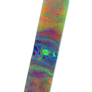
The term hyperspectral remote sensing describes, in simplified terms, the areal imaging of the earth's surface using spectrometers, which are characterized by a high number of spectral bands, a narrow spectral bandwidth and continuous coverage of the electromagnetic spectrum.
The latest earth observation satellites make use of the hyperspectral recording principle and thus enable a quantitative measurement of the radiation interaction of the earth's surface on a global scale. One example of this is the German EnMAP mission (Environmental Mapping and Analysis Program). We contribute to the scientific advisory group of the mission.
To transform this novel spectral data into quantitative information, we combine spectral modeling with machine learning techniques. This results in evaluation tools that are able to quantify the spatial dynamics of Earth surface variables.
While the spatial dynamics of environmental systems can be ideally captured by remote sensing, the mapping of temporally dynamic processes with satellites is only possible to a limited extent. However, temporal changes can be mapped very accurately using process-based models such as LPJmL.
Through data assimilation, it is possible to combine the advantages of remote sensing and modeling in order to investigate processes on the earth's surface with high temporal and spatial resolution.

Adjunct professor of remote sensing with a focus on hyperspectral applications in agriculture.
Mid-level representative, CIP representative, Audit Committee...