Example projects
funded by Studforschung@geo
funded by Studforschung@geo

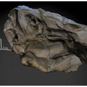
Project leader: Prof. Dr. Oliver Rauhut, period: winter semester 2018/2019
Marco Schade reported on his CT-based examination of a spinosaur skull. The results were published in the international journal Scientific Reports 2020. The research project was funded by two Studi_forscht@GEO projects.

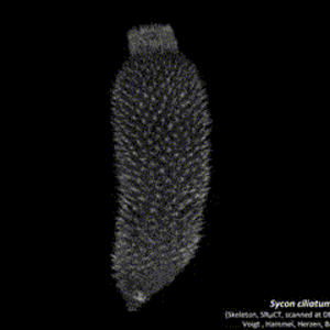
Project leader: Dr. Oliver Voigt, period: summer semester 2014
Objective: 3D visualization of the skeletons of fossil sponges using micro-computed tomography and AMIRA.
Background: Certain groups of sponges show a high degree of preservation in the fossil record. These include above all the lithistid sponges (Demospongiae, "stone sponges") and the pharetronid calcareous sponges (Calcarea). The skeletal organization in these sponges is an important morphological feature. This feature cannot be adequately visualized using classical methods such as thin sectioning.
Project procedure: As part of the Studi_forscht@GEO project, the potential of the micro-CT equipment of the Bavarian State Natural Science Collections (SNBS) is used for the 3D visualization of the skeletons of fossil sponges.

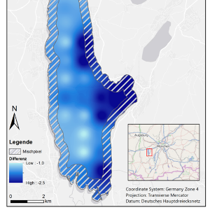
Project leader: Thomas Büche, period: winter semester 2013/2014
Goals: Investigation of the spatial distribution of the lake surface temperature
Evaluation of remote sensing data with regard to plausibility and suitability for processing further questions.
Background: In order to be able to investigate the dynamics of the surface temperature (Lake Surface Temperature, LST) of Lake Ammer, data series with a high measurement interval are required. The comprehensive collection of spatial data in the field is costly and time-consuming. For this reason, the LST was calculated using remote sensing data (AVHRR sensor) in cooperation with the DLR.
Project procedure: As part of the Studi_forscht@GEO project, it was investigated whether the LST can be derived from remote sensing data. To this end, the students processed the remote sensing data (georeferencing) and carried out a calculation at raster level and an error analysis. The results of the error analysis were then transferred to a map.
Your own project not represented? If you would like to present your student research project here, please contact the Student Office.