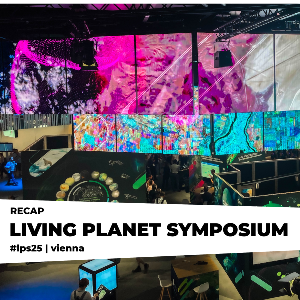
We were at ESA's Living Planet Symposium in Vienna!
2 Jul 2025
The focus was on how we can use remote sensing for improving climate action and sustainability.
2 Jul 2025
The focus was on how we can use remote sensing for improving climate action and sustainability.

Last week, attended ESA's Living Planet Symposium 2025 in Vienna – one of the largest international conferences dedicated to Earth Observation and environmental monitoring. More than 6,000 participants gathered to discuss the latest scientific advances, satellite missions, and data applications that help us understand our planet in unprecedented detail.
Our team joined thousands of remote-sensing colleagues at the Austria Centre Vienna, and – despite the 36°C heat – exchanged ideas on new satellite missions, data services and Earth-system models.
Here’s a detailed overview of the work we brought to #LPS25:
Christoph Jörges presented his work on an innovative approach to seasonal crop yield forecasting by merging Sentinel-3 satellite observations with the LPJmL vegetation model. His method incorporates the near real-time vegetation indicator FAPAR into the process, using machine learning and data assimilation to enhance model performance. By providing a more precise, dynamic picture of plant growth, this framework offers a promising foundation for scalable early-warning systems to support food security across Europe.
Stefanie Steinhauser presented how spaceborne hyperspectral data and hybrid approaches - combining simulated data with machine learning algorithms - can be harnessed to map crop nitrogen & dry biomass, supporting more sustainable agriculture. Using an EnMAP time-series over California’s Central Valley, the initial results reveal that seasonal dynamics can be effectively captured throughout the growing season. These promising findings highlight the potential of EnMAP and hybrid approaches to advance data-driven, sustainable land management in intensively farmed regions.
Accurately estimating forest biomass is important to understand how much carbon forests store and what role they play in global environmental change. But there are still large uncertainties in these estimates. Today, thanks to the many available satellite missions and data products, it is possible to improve biomass estimates. In this context, Benedikt Hartweg presented a novel approach that integrates satellite data (ESA Sentinel-1 & -2, NASA GEDI, ESA BIOMASS), process-based forest modelling, and machine learning to improve biomass estimates by enhancing traditional allometric models to be more flexible and location-specific. He and his colleagues successfully applied this method to simulated tropical test sites in Brazil, Costa Rica, and Panama. In the next steps, the framework will be scaled up using the upcoming ESA BIOMASS forest height product.